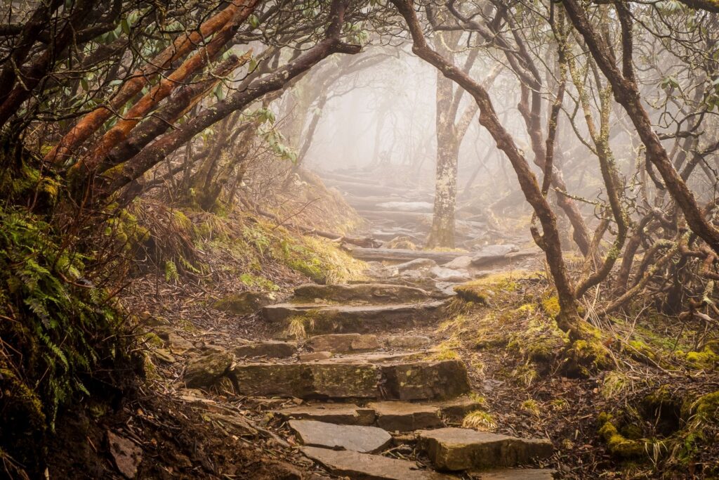
South Carolina isn’t all just beaches and barbecues! For those that want to get outside there are beautiful mountains, waterfalls, and hiking trails to explore. We love hiking in this beautiful part of the world and had to put together a list of the best hikes in South Carolina ranging in difficulty from easy to hard.
Getting outside in the mountains is one of the best things you can do in South Carolina. If you’re looking to get outside and adventure we’ll detail just where to go hiking in South Carolina!
Where to Go Hiking in South Carolina
Dismal Trail Loop (Including Raven Cliff Falls)
- Length: 8.8 mi
- Elevation Gain: 1,600 ft.
- Difficulty: Difficult
- Location: Caesars Head State Park
- AllTrails
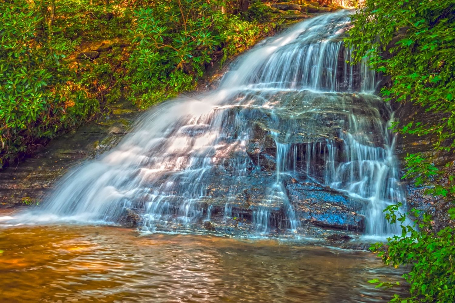
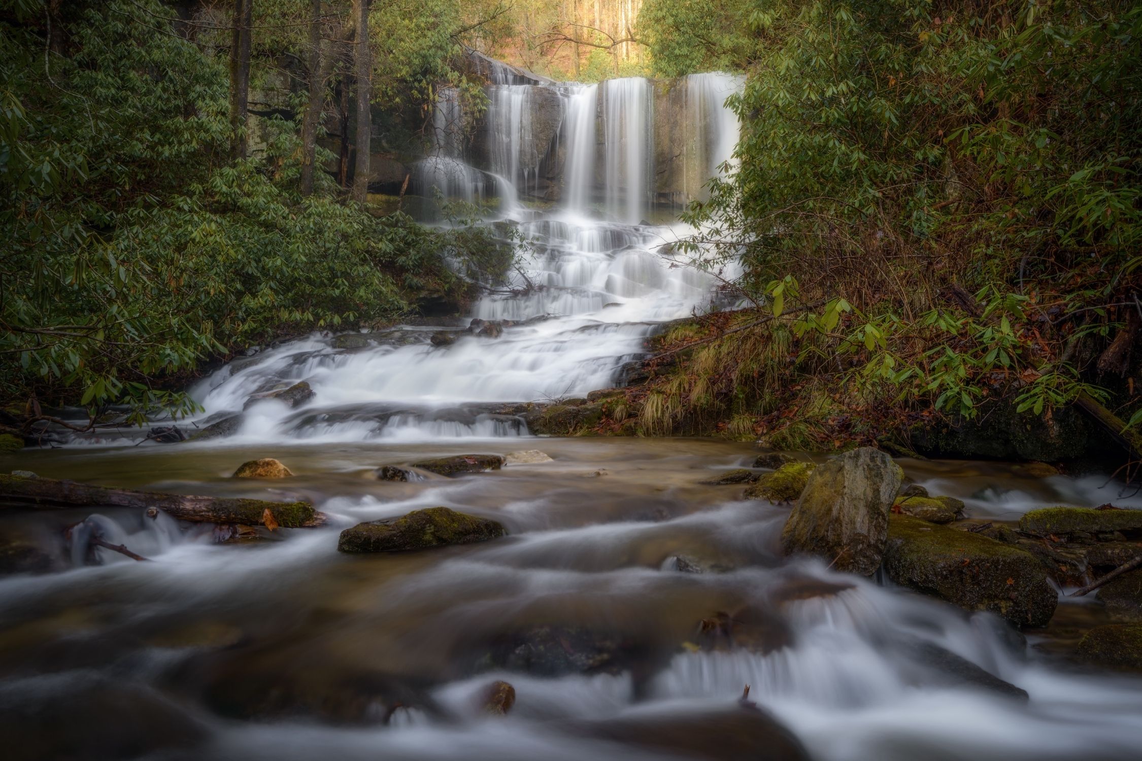
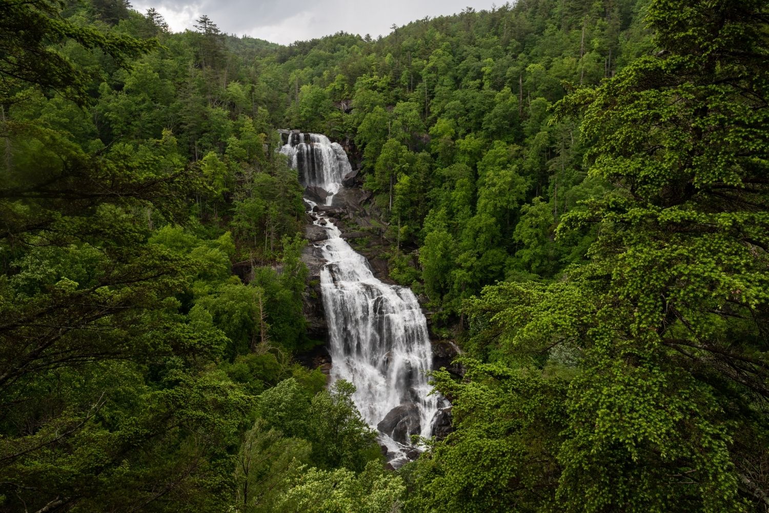
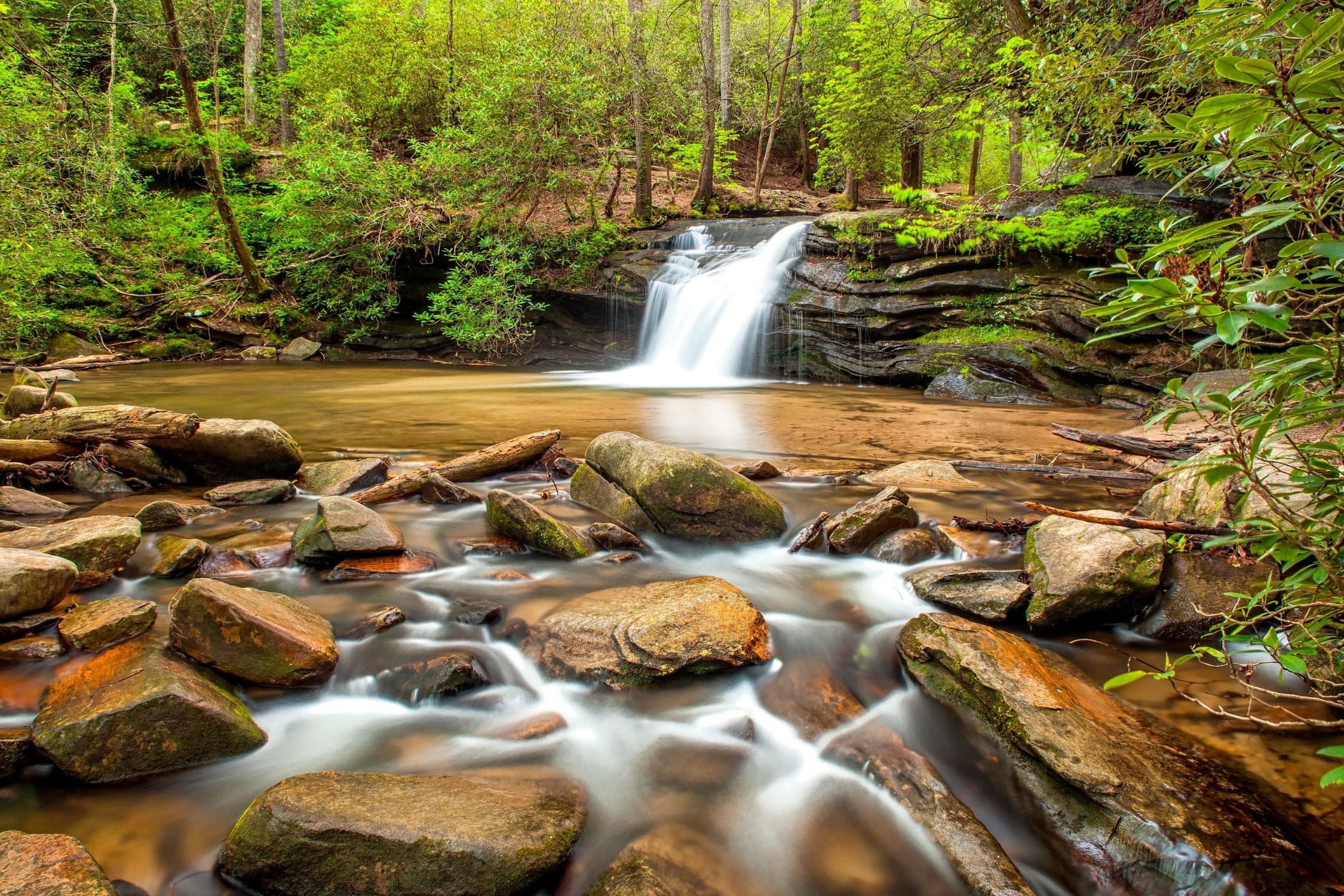
Maybe dismal on a rainy day, this pleasant 9-mile jaunt through natural settings doesn’t live up to its melancholy name. The loop carves through an area preferred by plants, animals, and humans alike. You’ll find hundreds of different bird species and steep rock faces across this trail. Keep venturing on as the heart of the loop is a view over Raven Cliff Falls, one of the largest waterfalls in the state, offering a great backdrop for a snack break.
Along the trail you’ll find yourself mustering the courage to cross rivers, wobbly bridges, and scramble up ladders to get through the more demanding sections of this hike.
Many waterfalls dot the trail, giving you plenty of sights to behold as you make your way. The Dismal Trail Loop has a little bit of everything and is a great choice for a full day in the woods.
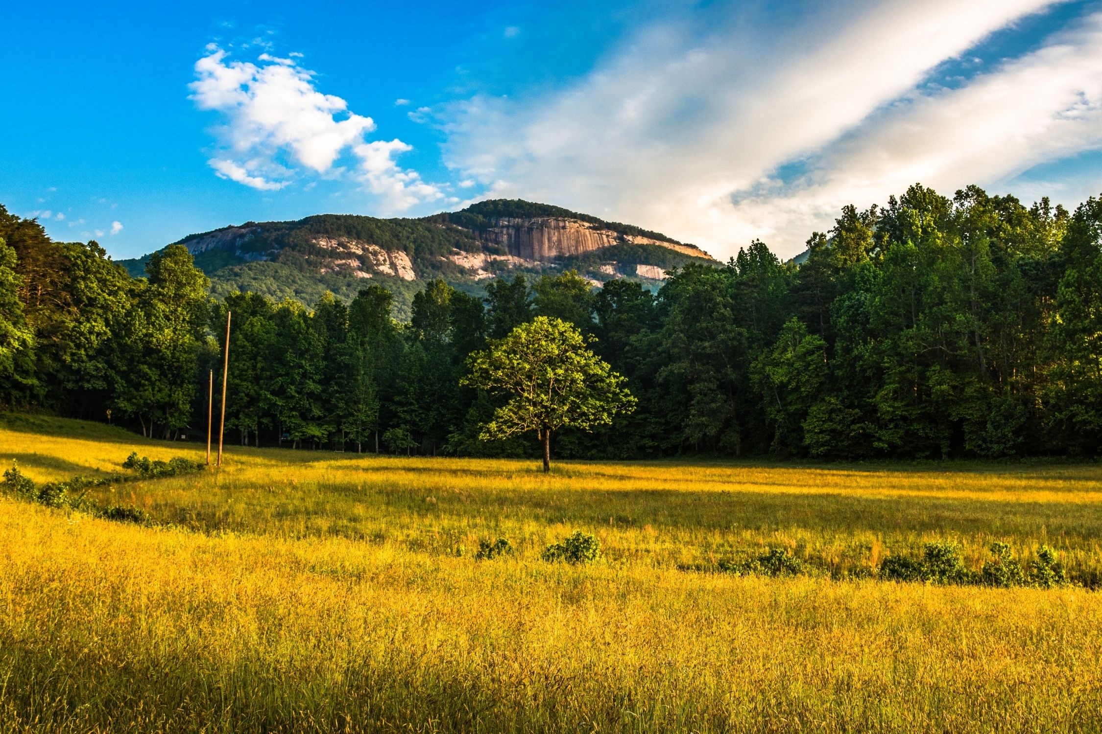
Table Rock Trail
- Length: 6.9 mi
- Elevation Gain: 2,316 ft
- Difficulty: Difficult
- Location: Table Rock State Park
- AllTrails
If you’re ready for 7-miles through South Carolina foothills, the Table Rock trail will keep your crew busy as you make your way. Boulders older than human history have taken unique shapes that provide a plethora of fun ways to get to the top of the rocks. The flatlands breed various wildflower species, and it wouldn’t be the South Carolina wilderness if there weren’t some waterfalls along the way to Table Rock.
The hike is a long, steady climb, so ensure your legs are ready. Once you reach Table Rock Lookout, you can dine amongst 360-degree views of Table Rock Reservoir, and you won’t have to bring your own table. It’s not an easy walk, but the hike is still well-suited for all ages for a grand day out.
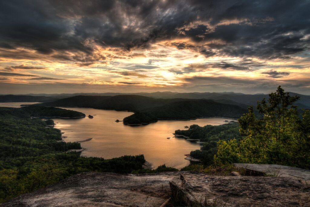
Lake Jocassee Trail
- Length: 15.6 mi.
- Elevation Gain: 2,322 ft.
- Difficulty: Difficult
- Location: Jocassee Gorges Management Area
- AllTrails
A 15-mile pathway that has broken off of the foothills trail provides many intimate looks around one of the most beautiful lakes in South Carolina, Lake Jocassee. Several campsites dot the path that heads through shrubs and old-growth forest before taking hikers up to Virginia Hawkins Falls.
The hike ends at Laurel Falls, where trekkers will find themselves on top of the cascading water with a one-of-a-kind view of the descent.
Blue Ridge Railroad Historical Trail
- Length: 4.4 mi.
- Elevation Gain: 490 ft
- Difficulty: Easy
- Location: Walhalla, SC
- AllTrails
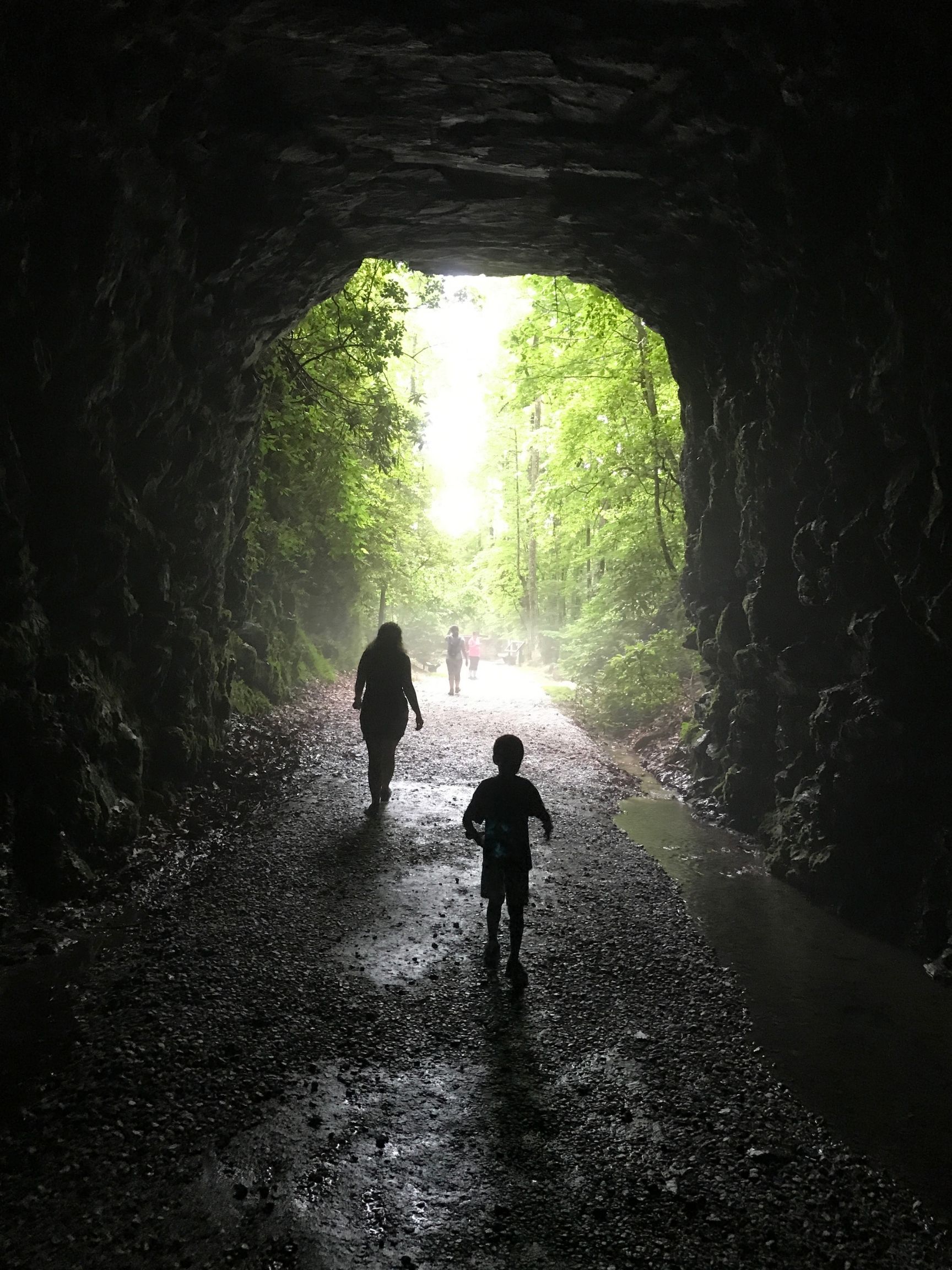
Hiking in South Carolina doesn’t get much more historical than this. A half-finished railroad cuts a line near the small SC town of Walhalla. Construction on a high-speed railroad meant to stretch to the Ohio Valley had barely gotten underway before the Civil War put the brakes on the plans. Construction never resumed, and the surrounding nature has reclaimed this railroad, creating a beautiful and easy trail to meander through.
Wanders who spend an afternoon amongst the railroad will get a unique combination of education and natural beauty. Markers dot the pathway to broadcast the area’s significance, and hikers can see a mix of flora in the rusted out tracks. The path crosses waterways through historic tunnels, never leaving the historic railroad’s side. This is a great hike if you’re looking for something short to do outside with the family.
Rainbow Falls Trail
- Length: 4.3 mi.
- Elevation Gain: 1,207 ft.
- Difficulty: Moderate
- Location: Jones Gap State Park
- AllTrails
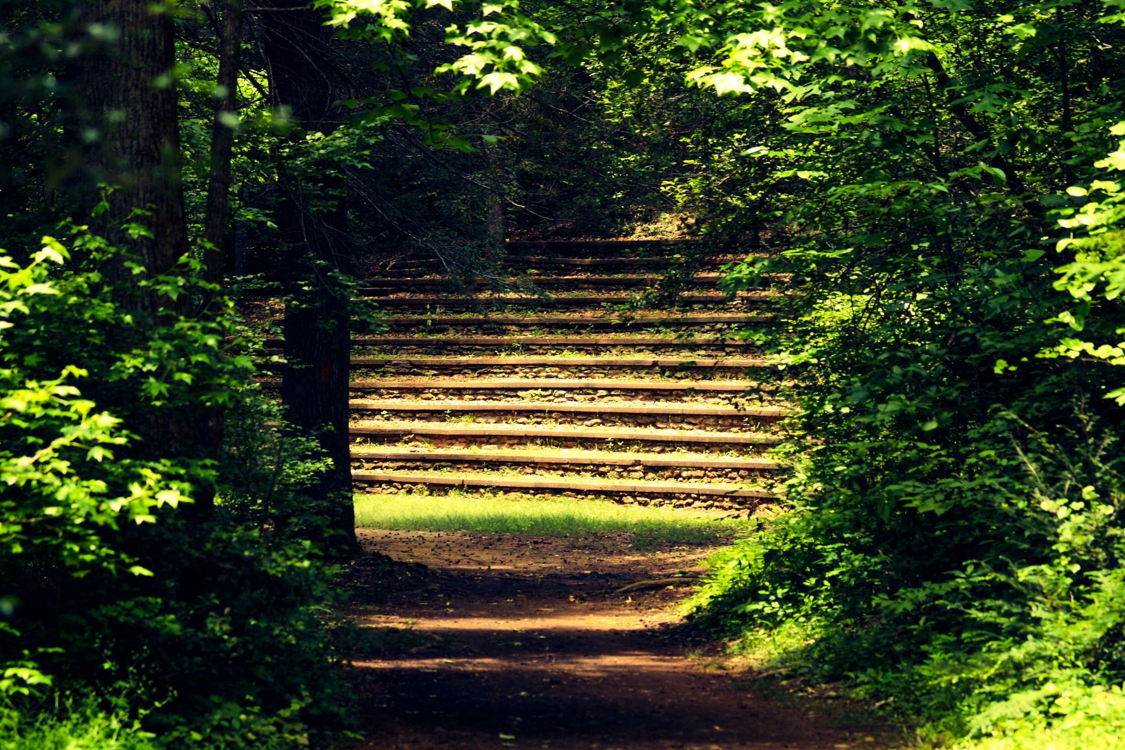
Five-miles of meandering cliff pathways intersect with rivers to gift hikers a wonderful afternoon outside. The trail is a highlight of Jones Gap State Park, where birdwatchers and nature lovers revel in a peaceful excursion. Some parts of this climb are a tad strenuous, but locals have built a set of natural stairs to allow the whole family to make it to the top of this waterfall.
For an authentic rainbow experience, head to the hike in the spring or fall. Springtime will see an explosion of mossy greens against the wet rocks and myriad patches of colorful wildflowers in bloom. Autumn winds knock the colorful leaves off the oak trees en-route, giving a rainbow field of colors above your head and a crunch below your feet.
Raven Rock Loop Trail
- Length: 4.2 mi
- Elevation Gain: 836 ft.
- Difficulty: Moderate
- Location: Keowee-Toxaway State Park
- AllTrails
This 4-mile loop is one of the most family-friendly hikes on our list. Walkers navigate a boulder field, natural bridges, and a balance along a ridgeline as they make their way through Ravens Rock. The ridgeline features plenty of outcroppings perfect for a picnic lunch, and travelers who want to get more out of their time in the woods will find a lakefront campsite in the middle of the loop.
The second half of the loop features most of the elevation changes, so make sure to save some energy for the walk home. Most of this pathway follows along Poe Creek until it reaches beautiful Lake Keowee, which is also a great spot to take a dip on hot summer days.
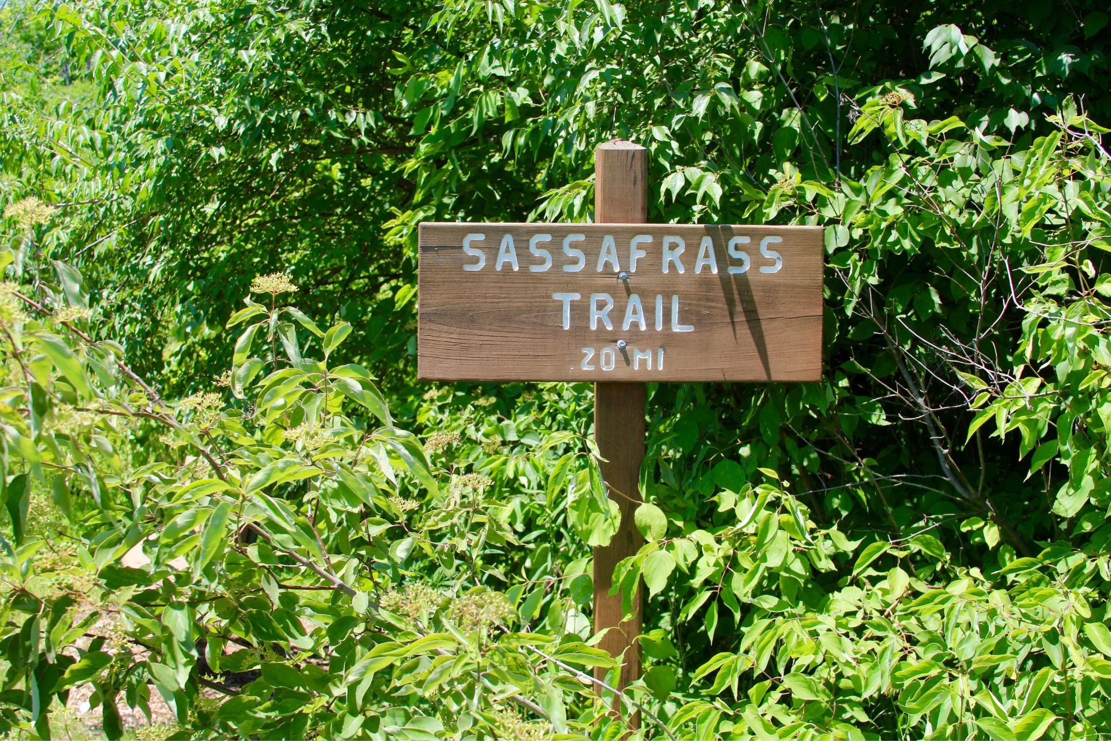
Sassafras Mountain
- Length: 8.2 mi
- Elevation Gain: 2,109 ft.
- Difficulty: Difficult
- Location: Highway 178
- AllTrails
When thinking about hiking in South Carolina it doesn’t get much more southern-sounding than a name like Sassafras Mountain. The hike features traditional Southern geography, as most of the trail is protected from the sun by various oaks and poplars. This trail is a doozy, with over 1,873 ft of elevation gain.
The trail’s high point is the views atop Sassafras Mountain, the largest peak in South Carolina. If you want a challenging hike that has a pay-off to match all your hard work, this trail is a fantastic combination of difficulty and beauty. Bonus that you get to say you’ve stood at South Carolina’s highest point.
Sassafras Mountain holds a unique appeal for highpoint enthusiasts. Positioned right on the boundary separating North Carolina and South Carolina, it proudly claims the title of South Carolina’s highest point. However, despite this distinction, it doesn’t hold the honor of being the loftiest mountain in the state due to its North Carolina origin at the base.
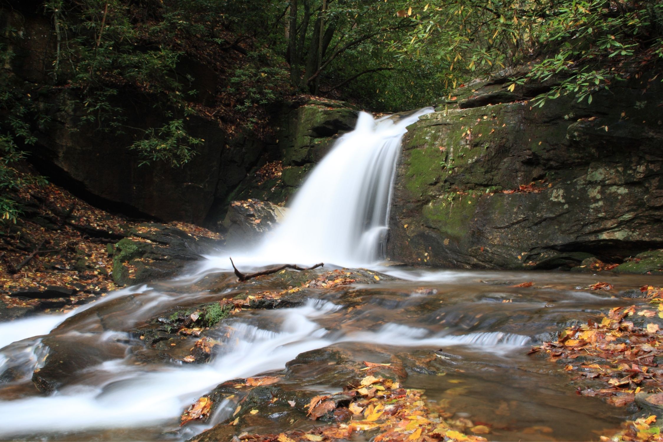
Spoonauger Falls
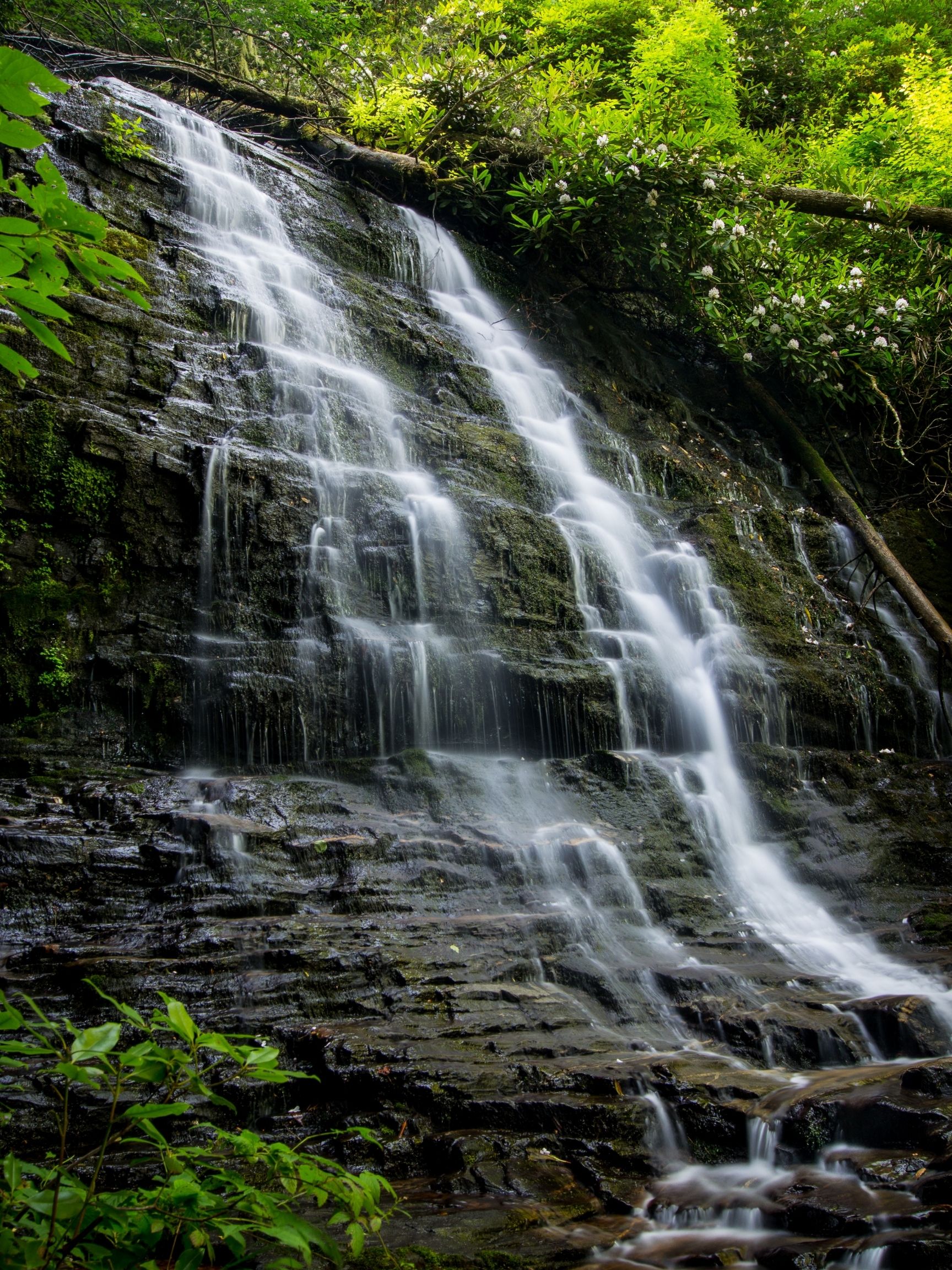
- Length: 0.6 mi.
- Elevation Gain: 111 ft.
- Difficulty: Easy
- Location: Ellicott Rock Wilderness
- AllTrails
South Carolina families favor this hike due to its short distance and beautiful views, with most hikers reaching the falls in just 20 minutes. Only a half-mile from the carpark, the pathway still feels like heading into another world, thanks to its location in the midst of the Chattooga River Gorge. The kids will have places to splash around, and parents find plenty of shade along the hillside.
A shallow pool at the bottom of the falls is a location with a rare inhabitant. Kids can frolic in the waters and search for various rare salamanders who feed off microscopic bacteria that fall from the waterfalls above. With plenty of activities for the whole family packed into a small area, Spoonauger Falls is an easy choice while traveling through South Carolina.
Chimney Top Gap
- Length: 3.1 mi
- Elevation Gain: 714 ft.
- Difficulty: Moderate
- Location: Jocassee Gorges Management Area
- AllTrails
A highlight of the foothills trail is this gap at the end of Laurel Valley. Three miles of walking takes you through wildflowers to a rock outcropping serving as a viewpoint for the surrounding valley and to Sassafras Mountain. The hike features a brutal uphill climb in its short length, making it a great training hike before attempting a longer journey.
If you finish the climb, you’ll be rewarded with a quiet, beautiful view of the valley below.
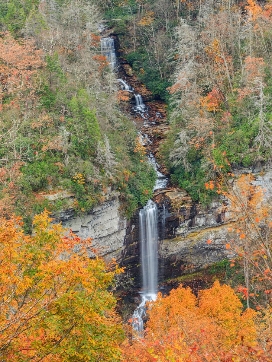
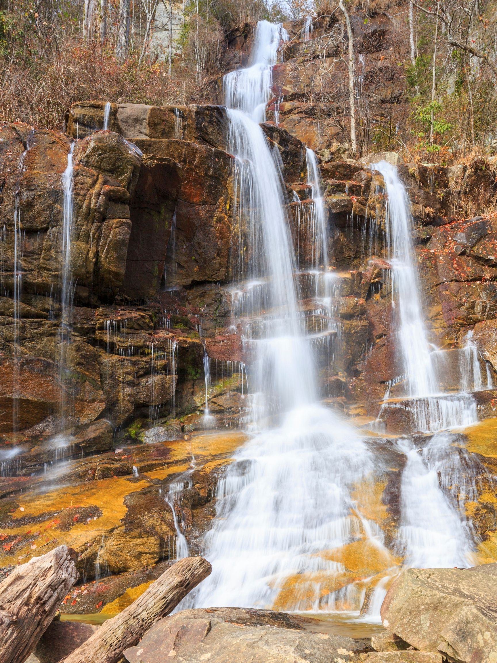
Lower Whitewater Falls
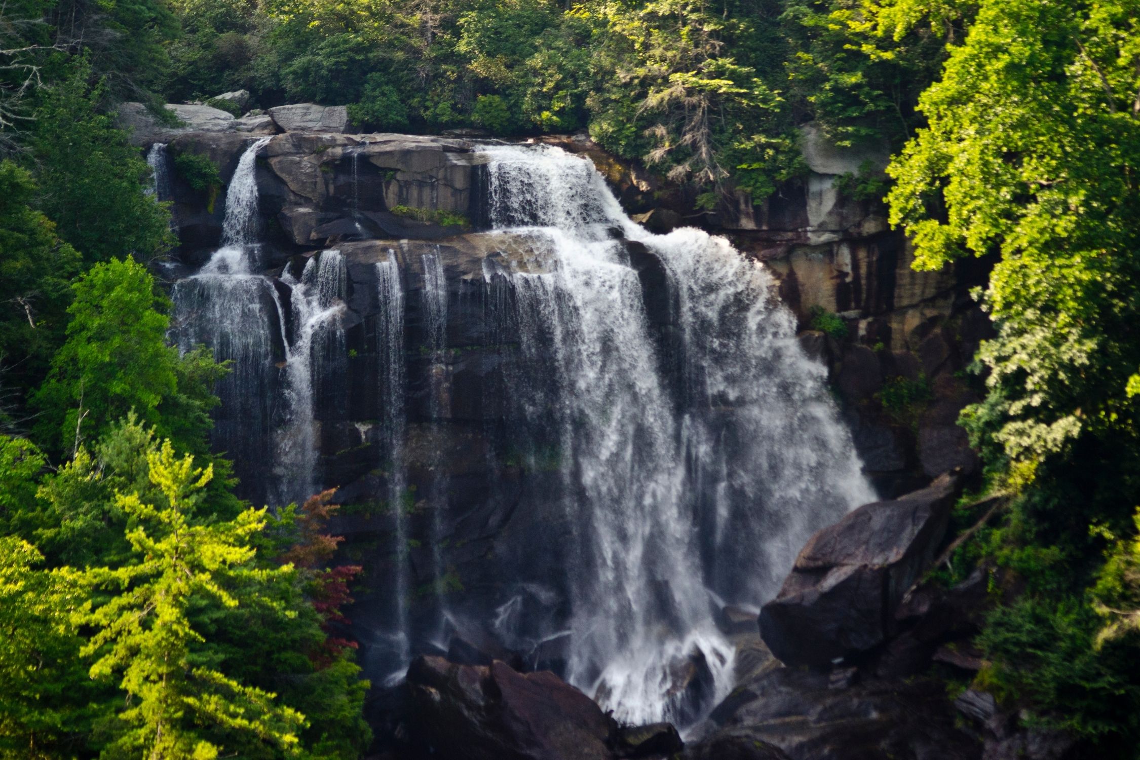
- Length: 4.2 mi
- Elevation Gain: 882 ft.
- Difficulty: Moderate
- Location: Sumter National Forest
Locals swear there are more separate cascades in this falls system than any other spot on the Eastern Seaboard, and the hike makes a compelling argument. A two-mile out-and-back section that starts at the Foothills Trail takes you straight to the source. The walk provides several glimpses through the forests to the immense nothingness of Jocassee Gorges and ends up atop the falls, letting visitors see how it all goes down.
The falls drop 200 feet at the highest point and have carved out the surrounding rocks all the way down. This can best be viewed from an observation platform at the end of the trail. The sculpting has left the destination with a unique offering of shaped rock surfaces to ponder while you catch your breath.
If you really want an epic waterfall hiking day, cross the Carolina border on foot (AllTrails route here) to see both Lower Whitewater Falls in South Carolina and Upper Whitewater Falls in North Carolina!
Pinnacle Pass
- Length: 17 Miles
- Elevation Gain: 4530
- Difficulty: Difficult
- Location: Caesars Head State Park
- AllTrails
Pinnacle Pass involves trekking over 10-miles through the most challenging sections of the Mountain Bridge Wilderness Area. This hike is best for those looking for a challenge, as you’ll find yourself burning energy around every corner. At the peak of the mayhem is a 2,000-foot climb that all takes place in less than half a mile.
Along the way, you’ll find Jones Gap off to one side and the Middle Saluda on the other, constantly feeling rewarded for your hard work. The trail tops out along the ridges of Little Pinnacle Mountain.
Keep a close eye on the little ones at this viewpoint; some of the granite cliffs that comprise the peak have nothing below them for thousands of feet. The feeling of being close to the edge is a one-of-a-kind experience, made better by the hard work required to get there.
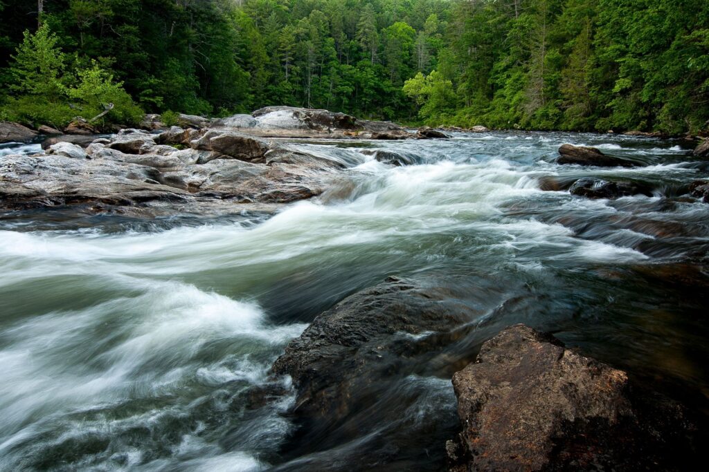
Chattooga River Trail
- Length: 16 Miles
- Elevation Gain: 547 ft.
- Difficulty: Moderate
- Location: Ellicott Rock Wilderness
Here’s another choice for a beautiful but longer hike through South Carolina. The trail takes up just over 15-miles round trip, all along the gorge carved out by the Chattooga River.
Whitewater will constantly be flowing around you during this journey, egging you onwards. There are plenty of places to stop along the way, and if you want to spend the night, you’ll find campsites right along the river.
The hike also passes the point at which South Carolina, North Carolina, and Georgia meet, Meaning you can head home and tell your friends you hiked through three states just to get there!
With federally protected wilderness abound, and trout-filled rivers leading the way, this hike has everything you need for a grand adventure in the South Carolina wilderness.
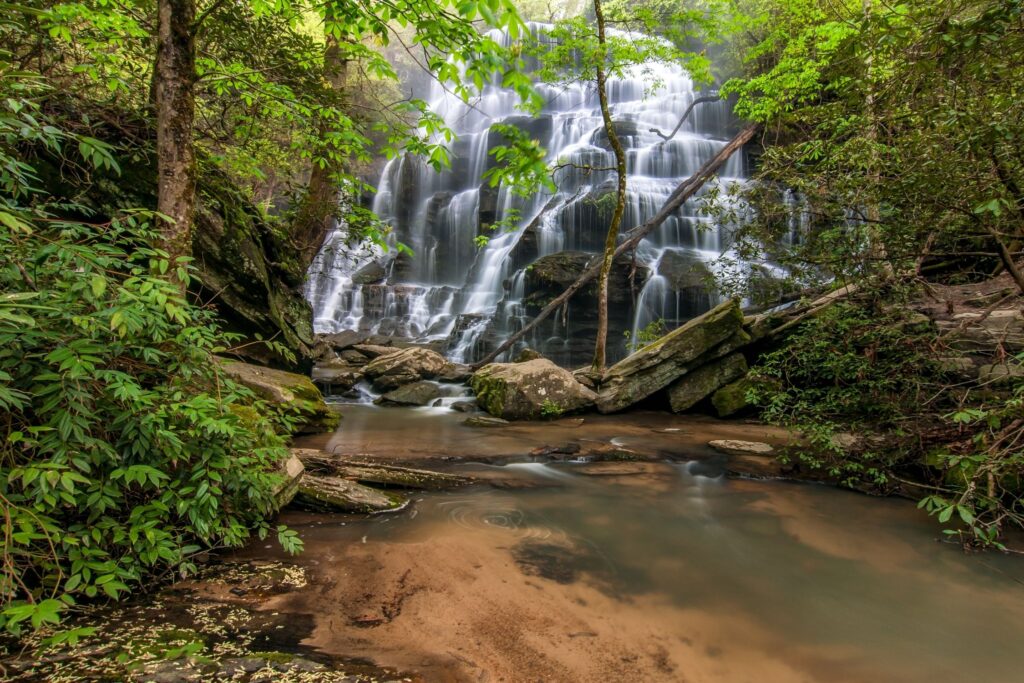
Yellow Branch Falls
- Length: 3 Miles
- Elevation Gain: 475 ft.
- Difficulty: Easy-Moderate
- Location: Sumter National Forest
- AllTrails
Yellow Branch Falls, situated in the picturesque Yellow Branch Picnic Area above Walhalla, may defy your expectations when you hear its name. Contrary to what the title suggests, this trail leads you to the base of a stunning 50-foot vertical cascade.
To embark on this moderately challenging out-and-back journey, start at the parking area and proceed along the Yellow Branch Nature Trail for approximately 0.2 miles until you reach the junction with the Yellow Branch Falls Trail.
You’ll pass through serene groves of majestic hardwood trees and traverse winding creek bottoms before eventually navigating the steep terrain. During the winter months when the trees have shed their leaves, you’ll have the opportunity to catch glimpses of the Walhalla vicinity as you hike.
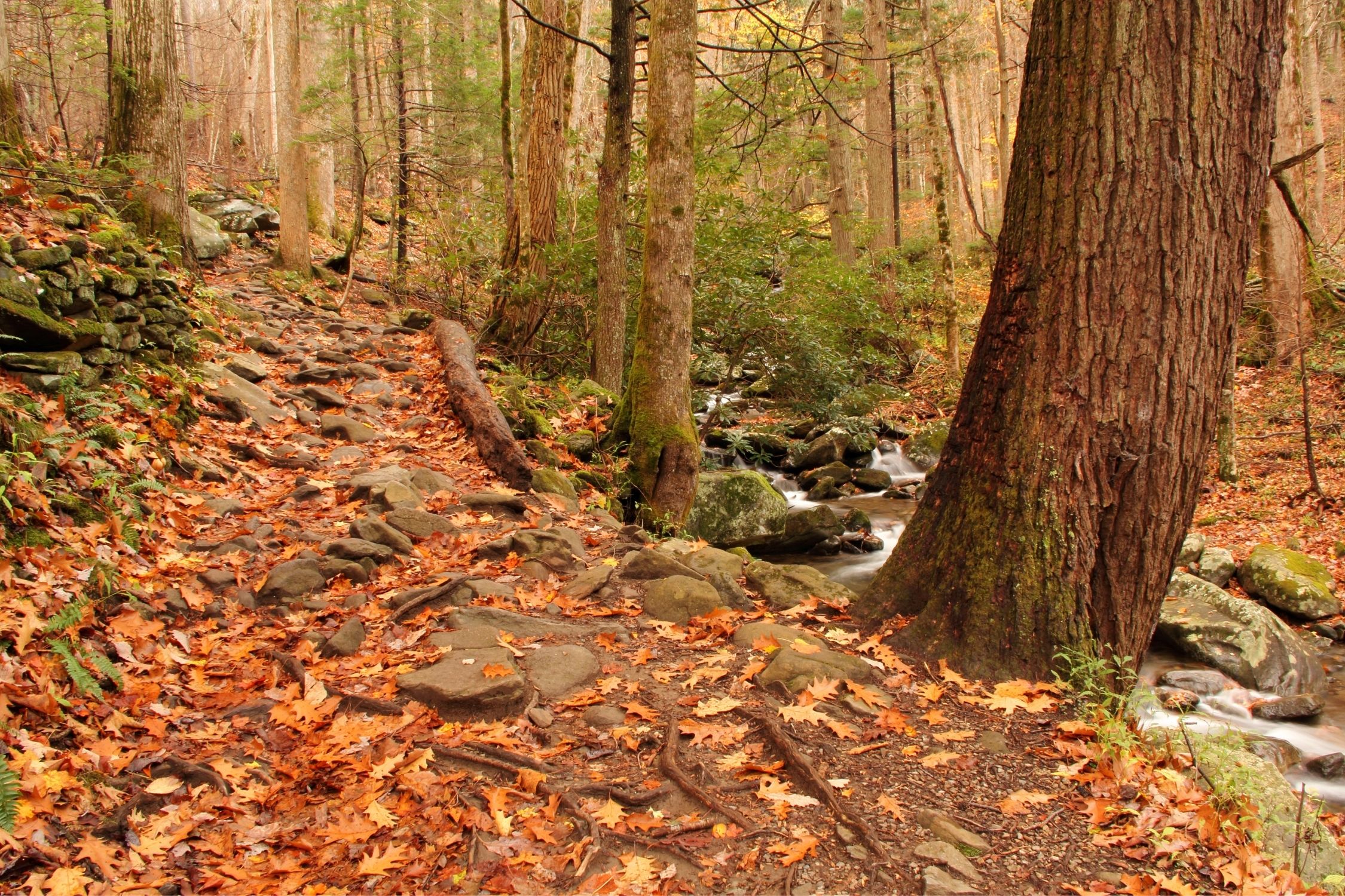
Carrick Creek Loop
- Length: 1.9 mi.
- Elevation Gain: 396 ft.
- Difficulty: Moderate
- Location: Table Rock State Park
- AllTrails
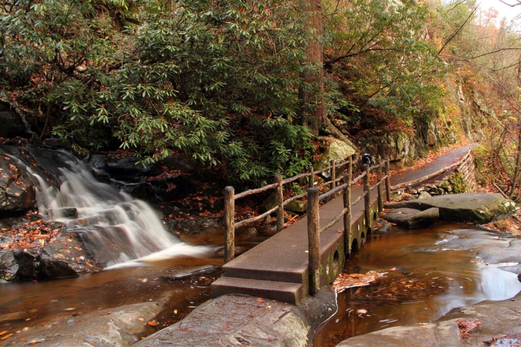
A good loop trail can sometimes be hard to find but this 1.5-mile offering keeps things interesting throughout the journey, while still being accessible to all ages. The hike immediately takes you down to the Chauga River, and you’ll stay along the roaring water through most of the walk.
Several deeper pools of calmer water are perfect for swimming, usually signified by a small rope swing. In the middle of the loop is the Riley Moore Falls, a gentle cascade that supports a lively pool underneath the falling water.
Sulphur Springs Trail
- Length: 4.5 mi
- Elevation Gain: 695 ft.
- Difficulty: Moderate
- Location: Paris Mountain State Park
- AllTrails
If you’re looking to go hiking in South Carolina near the city of Greenville the Sulphur Springs Trail is just for you! Deep inside of Paris Mountain State Park lies 4-miles of slightly challenging pathways that take hikers into the Mountain Lake reservoir.
The loop trail features some inclines and rocky sections, but there’s nothing here a good pair of boots won’t solve. The trail features mountain springs, footbridges, and a few scrambles up steep sections towards the heart of the pinewood forest.
The middle of the trail is an old dam with a viewing tower and many quartz faces along the water’s edge. The path is perfect for novice hikers looking for a challenge or families who are a bit comfortable getting their knees dirty.
Lee Falls Trail
- Length: 2.9 mi
- Elevation Gain: 347 ft.
- Difficulty: Moderate
- Location: Sumter National Forest
- AllTrails
Here you’ll find a great out and back trail leading to beautiful Lee Falls. The course is a hidden gem of South Carolina, and we mean that literally. Navigating to the waterfall at the end of this 3.5-mile hike isn’t so easy to spot. Hikers should expect to get wet and to do a bit of climbing, but anyone who loves to get off the beaten path will have a grand day exploring this fall.
The hike starts as a breezy walk, crossing creeks and marching through fields. Eventually, you’ll end up in the woods and follow a river upstream towards the falls. Once you get close, you’ll have to get a bit creative, figuring out how to bounce from rock to rock to make it up to the top. If you don’t like following strict guidelines, you can let your mind wander along with your feet at this route.
With all this in mind, this is not the best hike in South Carolina for children.
Foothills Trail
- Length: 77 mi.
- Elevation Gain: Varies
- Difficulty: Difficult
- Location: Oconee State Park, Table Rock State Park, Sumter National Forest, Ellicott Rock Wilderness
- AllTrails
The total length of this trail is 76-miles, so don’t set out to the beginning expecting to finish. What makes this hike one of the best in South Carolina is the variety of options you can find along the way. The trail strikes through Oconee State Park, Table Rock State Park, Sumter National Forest, and Ellicott Rock wilderness, providing a look at the best of each stop along the way.
Find the section nearest you to see a part of the trail without expecting to finish the whole route. It’s a point-to-point trail, so when you feel about halfway done with walking, simply turn around and leave the way you came in.
If you are looking for a longer multi day hike, this is one of the most fantastic options in South Carolina but it’s not something that you should take lightly. Only seasoned backpackers should plan on making the entire journey, and you should carve out plenty of time to do so. You can read all about the Foothills Trail here.
Oconee Bells Nature Trail

- Length: 1.5 mi.
- Elevation Gain: 144 ft.
- Difficulty: Easy
- Location: Devils Fork State Park
- AllTrails
A flat, one-mile slice of Devils Fork State Park, this trail gives the whole family easy access to the beauty of the naturally preserved area. The highlight of this walk is the various wildflower species that bloom in March and April. Throughout the year, the Oconee Bells trail gets its name for taking shape next to the river.
No matter when you go, you’ll feel plenty of tree coverage in this old-growth hardwood forest. For a fantastic family trip into the woods, this pathway is an excellent choice.
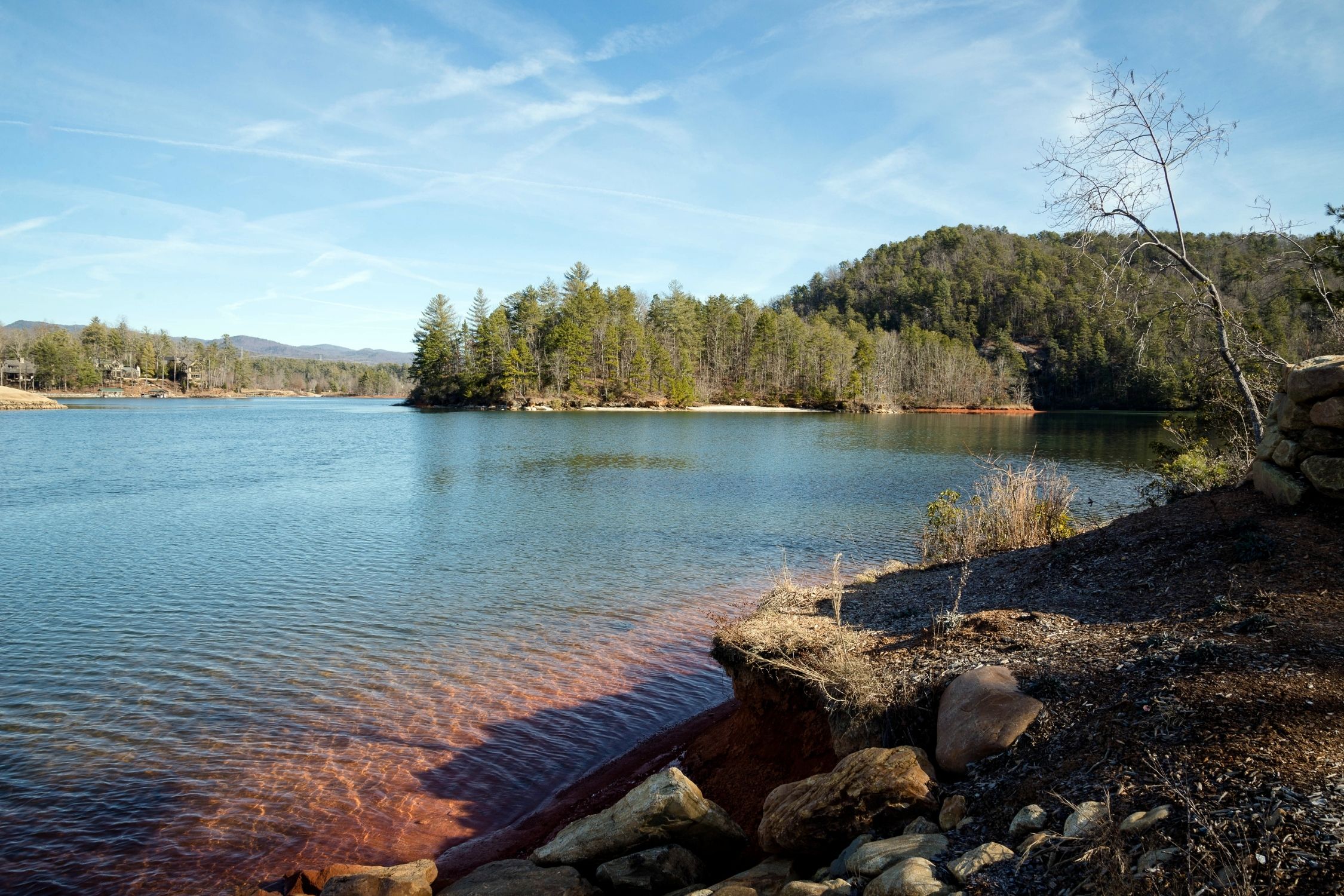
Jumping Off Rock Overlook
- Length: 0.2 mi.
- Elevation Gain: 20 ft.
- Difficulty: Easy
- Location: Lake Jocassee
- AllTrails
Getting a great glimpse of Lake Jocassee isn’t always easy, but Jumping Off Rock provides one of the best viewpoints across the whole lake. You won’t have to walk much from the carpark to get to the overlook, but there’s plenty of fun to be had once you arrive at the rock.
In the springtime, Peregrine Falcons favor the area for nesting. From March through October, the weather stays warm enough to hike up this overlook and then take a cooling splash in Lake Jocassee below. The overlook is a real journey to reach as it follows up a rough gravel road that can be driven, biked, or you can utilize the foothills trail .
Falls Creek Waterfalls
- Length: 2.7 mi.
- Elevation Gain: 223 ft.
- Difficulty: Moderate
- Location: Mountain Bridge Wilderness
- AllTrails
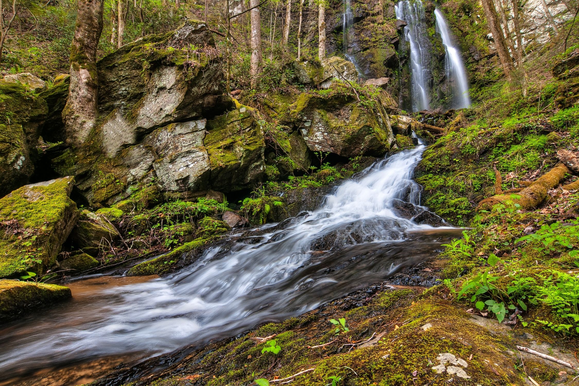
Fall Creek Falls, a picturesque 40-foot waterfall, graces the vicinity of Mountain Rest, SC. The falls sit amid 40,000-acres of the Mountain Bridge Wilderness.
To access these falls, you’ll need to head deep into the heart of the woods, allowing you to get away from it all in style. At the top of the hike is more than just the waterfall.
As you embark on this journey, you’ll also have the opportunity to marvel at the beauty of Andrew Ramey Falls and Pristine Falls. Andrew Ramey Falls will come into view shortly after you begin your hike, cascading down the hillside. As you press on, a split leading to Pristine Falls on the left will guide you over the creek, up a gentle incline, and down a steep bank to reach the falls’ base. On the right side of the split, you’ll continue along the creek’s path until you reach the breathtaking Fall Creek Falls.
It’s important to note that these trail sets aren’t meticulously maintained and traverse steep terrain. This is one of those hiking trails best left to experienced hikers.
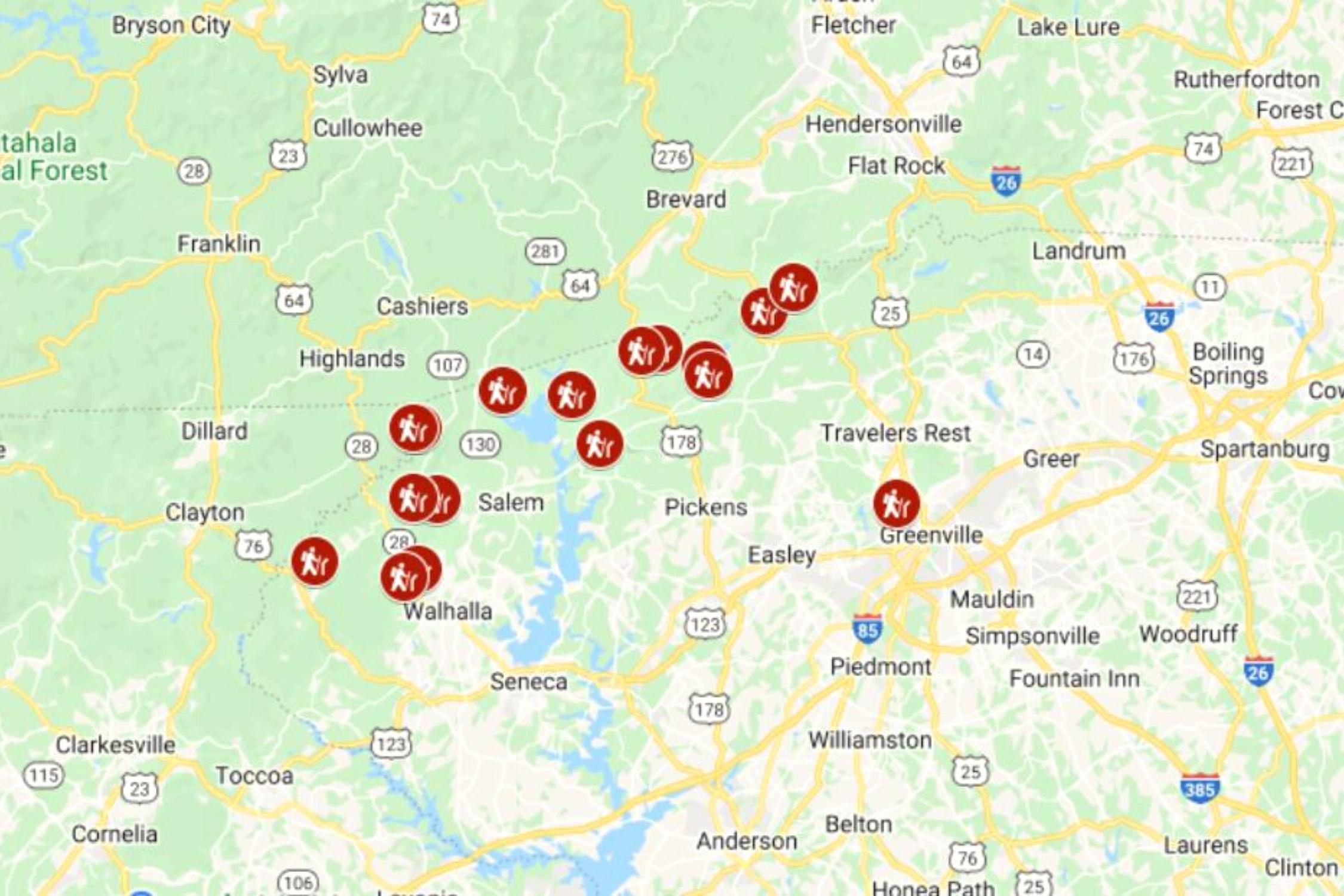
Best Hikes In South Carolina Map
Does South Carolina have good hiking trails?
South Carolina boasts over 400 trails that allow hikers to explore some of the state’s most breathtaking landscapes. These trails grant access to remarkable natural wonders, such as the National Wild and Scenic Chattooga River, the Mountain Bridge Wilderness Area, and the Jocassee Gorges. Within all this wilderness there are some fantastic hiking trails!
when is the best time to go hiking in South Carolina?
South Carolina is unlike many areas of the world where the mountains turn into a wintery wonderland come winter and hiking season turns to ski season. You can go hiking in South Carolina year round, though the best time to go hiking in the Appalachian Mountains is during the summer and fall season, when the weather cools off and you won’t be constantly thinking about AC.
do i have to worry about bears while hiking in South Carolina?

Black bears live in South Carolina, and inhabit two distinct resident populations. One resides in the mountainous regions and upper Piedmont, while the other thrives in the coastal plain. It’s likely to see them while hiking in Sumter National Forests.
While hiking in South Carolina you will need to make sure you are bear-aware. We recommend hiking with bear spray in many areas of South Carolina, hike with others, and chat among yourselves while hiking. Bears don’t like human confrontation, and if they hear you they will likely walk the other way.
Leave No Trace
When hiking in South Carolina always remember to practice Leave No Trace principles. This means to respect wildlife and not feed any wild animals. Leave the area how you found it, dispose of waste properly, and always pack out what you bring in. Be considerate of others on the trail and be good custodians of the earth.
Best State Parks in South Carolina
South Carolina offers a wealth of beautiful state parks, each with its unique charm and attractions. Here are some of the best state parks in South Carolina for hiking.
- Table Rock State Park: Situated in the Blue Ridge Mountains, this park offers hiking trails, a beautiful lake, and the iconic Table Rock Mountain.
- Devils Fork State Park: This park is famous for its crystal-clear Lake Jocassee, known for its excellent fishing, boating, and waterfalls.
- Caesars Head State Park: Another mountain gem, this park offers stunning views from the Caesars Head overlook and a variety of hiking trails.
- Jones Gap State Park: Part of the Mountain Bridge Wilderness Area, this park features rugged terrain, waterfalls, and excellent hiking options.
- Paris Mountain State Park: Just outside Greenville, this park offers hiking, biking, and picnicking, making it an ideal spot for a day trip.
Plan For Your Trip to the South!
- We like to use VRBO when searching for vacation apartment rentals and Hotels.com when searching for hotels.
- See our favorite cooler for the road!
- Get Around: We suggest renting a car for traveling the Carolinas. Check Prices on Expedia.com
- Our Favorite Brand of Shoes: Our answer to this question is always Keen. When hiking, enjoying the beach, or just needing a comfortable shoe for daily wear, this it it.
- Check out our favorite South Carolina Souvenir! Or for the coffee or tea lover in the family!